Waterfalls
Easily Accessible Waterfalls within 25 Miles of the Dahlonega Area
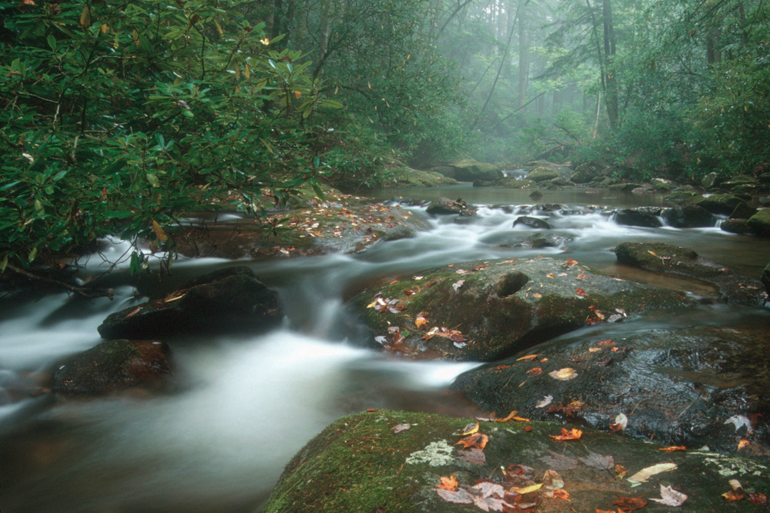
The North Georgia mountains contain over 100 waterfalls, some on public lands and many on private property. This guide will allow you to experience 12 spectacular falls that are easily accessible on public lands or viewable on private land. When viewing waterfalls, remember that the water level affects the aesthetic qualities. The guide is organized by proximity to Dahlonega.
(USFS) – Land and water ownership. Highway right-of-way and non-fee USFS parking is uncontrolled and often remote. Be sure to lock the vehicle and take valuables. Private Property (PRI); Army Ranger Camp (ARC); USFS (US Forest Service); State of Georgia (GA)
Cane Creek Falls (PRI)
Cane Creek Falls is a spectacular waterfall on Cane Creek, a tributary of the Chestatee River. The falls are located inside Camp Glisson, and as such, are open to the public only when camp is not in session. There is a gate at the entrance and signs indicate when the camp is closed to the public.
Getting there from Dahlonega Square: 2.9 miles. Take Main Street east 0.1 mile to the traffic light at Grove Street. Turn left and remain on North Grove Street/Alt 19 to Camp Glisson Road in 2 miles. Turn left onto Camp Glisson Road and go .8 miles to the Camp Glisson gate. If open, proceed ahead to the parking area on the left beside the creek. There is a viewing platform above the falls at the parking area.
Clay Creek Falls, (PRI)
Clay Creek Falls is located on private property, but is viewable from Clay Creek Falls Road. There is not a place to park to observe the falls on foot, but it is very close to the road and well worth a drive by to see it, especially when the water is at higher levels.
Getting there from Dahlonega Square: 2.9 miles. Take Main Street west 0.6 mile to Morrison Moore Parkway (Hwy 52/9). Turn right onto Hwy 52/9 and go 1.6 miles to Clay Creek Falls Road. Turn right on Clay Creek Falls Road. Clay Creek is immediately on the right side of the road. The falls are at .7 miles on the right.
Black Falls, (ARC)
Black Falls is one of the higher falls in this guide. It is located on the Etowah River and on the property of Camp Frank D. Merrill, which is the Army Ranger training camp located in the Chattahoochee National Forest near Dahlonega. If the gate is open, it is permissible to park at the base of the falls to observe them. There is a wooden bridge across the creek which makes an excellent place for photographs. The falls parking lot is near the climbing wall and other training facilities, so it is possible that the area may be restricted at some times.
Getting there from Dahlonega Square: 11.4 miles. Take Main Street east two blocks to the first traffic light and turn left on Grove Street. After 2.2 miles, turn left on Camp Wahsega Road. In 8.5 miles, at the four way stop and entrance to the Ranger Camp at concrete barricades, turn left to remain on Camp Wahsega Road. Go .5 mile and turn right onto Cloverleaf Trail at the Army Ranger sign. The road ends at the parking area at the base of the falls.
Montgomery Creek Falls, (USFS)
Montgomery Creek Falls is the most isolated falls included in this guide. It requires hiking on an old logging road for about .5 mile to reach, but is a spectacular 20 foot falls.
Getting there from Dahlonega Square: 11.2 miles. Take Main Street east two blocks to the first traffic light and turn left on Grove Street. After 2.2 miles, turn left on Camp Wahsega Road. In 8.5 miles, at the four way stop and entrance to the Ranger Camp at concrete barricades, turn left to remain on Camp Wahsega Road. Go .2 mile and turn right onto Merrill Drive at the chain link fence gate at the Ranger Camp gym.
Go through the camp facilities and cross the Etowah River at the ford. Stay straight ahead on the old logging road until the split, one straight ahead, one a sharp right. Park here on the side of the road. Walk on the road that goes straight ahead. After a few hundred yards, take the right fork for about .4 mile until you see the falls on the left on Montgomery Creek. This series of old logging roads is part of a mountain bike trail, so watch for bikes.
Dicks Creek Falls, (USFS)
Dicks Creek Falls is actually a couple of waterfalls located on Dicks Creek in the Chattahoochee National Forest. This exceptional falls is a very popular swimming and fishing area for local people.
Getting there from Dahlonega Square: 16 miles. Take Main Street east 0.6 mile to Morrison Moore Parkway. Turn left and remain on Morrison Moore/Hwy 19/60 to Stonepile Gap in 7.3 miles. At the split in the road at the pile of stones, take Hwy 19 to the right for 4.8 miles. Turn left on Dicks Creek Road at the Forest Service sign. (Turners Corner General Store is .2 miles further on Hwy 19). Go 2.7 miles to the parking area and toilet at Dicks Creek Falls.
DeSoto Falls, (USFS)
DeSoto Falls consists of an upper falls and a lower falls. The upper falls is a .75 mile hike up the creek and the lower falls is .25 mile downstream. The total drop of all the falls is 480 feet.
Getting there from Dahlonega Square: 18 miles. Take Main Street east 0.6 mile to Morrison Moore Parkway. Turn left and remain on Morrison Moore/Hwy 19/60 to Stonepile Gap in 7.3 miles. At the split in the road at the pile of stones, take Hwy 19 to the right for 5.3 miles. At the intersection at Turners Corner Restaurant, turn left remaining on Hwy 19 for 4.2 miles. The DeSoto Falls Recreation Area islocated on the left of Hwy 19 and is marked by a Forest Service sign.
Long Creek Falls, (USFS)
Long Creek Falls is another waterfall with a large pool at the bottom that is a popular swimming location for locals. The hike to Long Creek Falls is .9 mile on the Appalachian Trail and Benton MacKaye Trail. It is one of the most scenic hikes to a waterfall in this guide.
Getting there from Dahlonega Square: 21 miles. Take Main Street west 0.6 mile to Morrison Moore Parkway (Hwy 52/9). Turn right and follow to the divergence of Hwy 52 and Hwy 9 in 3.6 miles. Bear right onto Hwy 52. In 4.6 miles, turn right onto Nimblewill Church Road at the old Grizzle’s Store. In 2.3 miles at Nimblewill Church, turn right onto FS 28-1. Follow this for 2.1 miles to the fork. Stay left on Winding Stair Gap Road (FS 77) and go another 5.0 miles. This is a Forest Service road and may be rough in spots, especially near the top of the gap. Any vehicle that can be driven on dirt roads should have no problems. (See the Springer Mountain description below for a much longer alternate route on less Forest Service roads. If using this route, go past the Springer Mountain parking lot for 2.6 miles to turn left on FS 58 and follow directions ahead.) At the top of the gap, at the junction with FS 42, go straight ahead and down the north side of the mountain on FS 58 for 2.6 miles. The parking for Three Forks (Long Creek Falls) is on dirt areas at the crossing of the AT.
Helton Creek Falls, (USFS)
Helton Creek Falls is one of the most spectacular falls found in this guide. It, like several others, consists of two separate falls, each very scenic on its own. The hike to the upper falls is .2 miles on a combination dirt trail and boardwalk.
Getting there from Dahlonega Square: 25 miles. Take Main Street east 0.6 mile to Morrison Moore Parkway. Turn left and remain on Morrison Moore/Hwy 19/60 to Stonepile Gap in 7.3 miles. At the split in the road at the pile of stones, take Hwy 19 to the right for 5.3 miles. At the intersection at Turners Corner Restaurant, turn left, remaining on Hwy 19 for 9.3 miles. Turn right onto Helton Creek Road and go 2.2 miles to the parking area. Most of Helton Creek Road is a Forest Service road and is a rough dirt track passable to any vehicle that can handle dirt roads.
Dukes Creek Falls, (USFS)
The 1.25-mile trail descends from the parking lot with toilets to observation decks at the foot of the 150-foot falls. The trail is in a narrow canyon with numerous large trees. The falls is actually on Davis Creek at the confluence with Dukes Creek.
Getting there from Dahlonega Square: 24 miles. Take Main Street east 0.6 mile to Morrison Moore Parkway. Turn left and remain on Morrison Moore/Hwy 19/60 to Stonepile Gap in 7.3 miles. At the split in the road at the pile of stones, take Hwy 19 to the right for 5.3 miles. At the intersection at Turners Corner Restaurant, turn right on Hwy 129 for 7 miles. Turn left onto Hwy 75 ALT. Smithgall Woods is on the right of Hwy 75 ALT after 5.7 miles. Just past Smithgall Woods (0.15 mile), turn left on Hwy 348, the Richard B Russell Scenic Highway. After 1.7 miles, the paved parking area is on the left.
Raven Cliff Falls, (USFS)
Raven Cliff Falls is one of the most popular hikes in the Chattahoochee National Forest that is not on the Appalachian Trail. The trail to the falls is 2.5 miles one way from the parking lot. Raven Cliff Falls totals 100 feet in three drops. The trail follows Dodd Creek from the parking lot to the falls.
Getting there from Dahlonega Square: 25 miles. Take Main Street east 0.6 mile to Morrison Moore Parkway. Turn left and remain on Morrison Moore/Hwy 19/60 to Stonepile Gap in 7.3 miles. At the split in the road at the pile of stones, take Hwy 19 to the right for 5.3 miles. At the intersection at Turners Corner Restaurant, turn right on Hwy 129 for 7 miles. Turn left onto Hwy 75 ALT. Smithgall Woods is on the right of Hwy 75 ALT after 5.7 miles. Just past Smithgall Woods (0.15 mile), turn left on Hwy 348, the Richard B Russell Scenic Highway. After 2.7 miles, the paved parking area is on the left. It is about a mile past the Dukes Creek Falls Trail parking lot.
Amicalola Falls, (GA)
Amicalola Falls is 729 feet high and is the highest waterfall east of the Mississippi River. Park at the bottom for a view up the falls. There is a staircase that goes up the left side of the falls. If not taking the stairs, one can also drive to the top of the falls to the parking area for viewing the panoramic scene to the south of the park.
Getting there from Dahlonega Square: 19 miles. Take Main Street west 0.6 mile to Morrison Moore Parkway (Hwy 52/9). Turn right and follow to the divergence of Hwy 52 and Hwy 9 in 3.6 miles. Bear right onto Hwy 52 for 14 miles. Turn right into Amicalola Falls State Park entrance. There is a fee for entry. The Visitor’s Center is located at the bottom of the falls and parking for the staircase up the falls is past the Visitor’s Center a few hundred yards.